Are you trying to decide between the north and south ends of Lake Lanier from your home base in Flowery Branch? You are not alone. The lake offers very different day-to-day experiences depending on where you land, from quiet coves to amenity-rich marinas. In this guide, you will learn how each side lives, what to check on a tour, and how to match the area to your boating, drive-time, and property goals. Let’s dive in.
Lake Lanier basics from Flowery Branch
Lake Lanier is a reservoir created by Buford Dam and managed by the U.S. Army Corps of Engineers. It stretches across several counties with broad southern arms and long, narrower northern arms. You can explore lake operations, safety, and shoreline rules on the official U.S. Army Corps of Engineers Lake Lanier site.
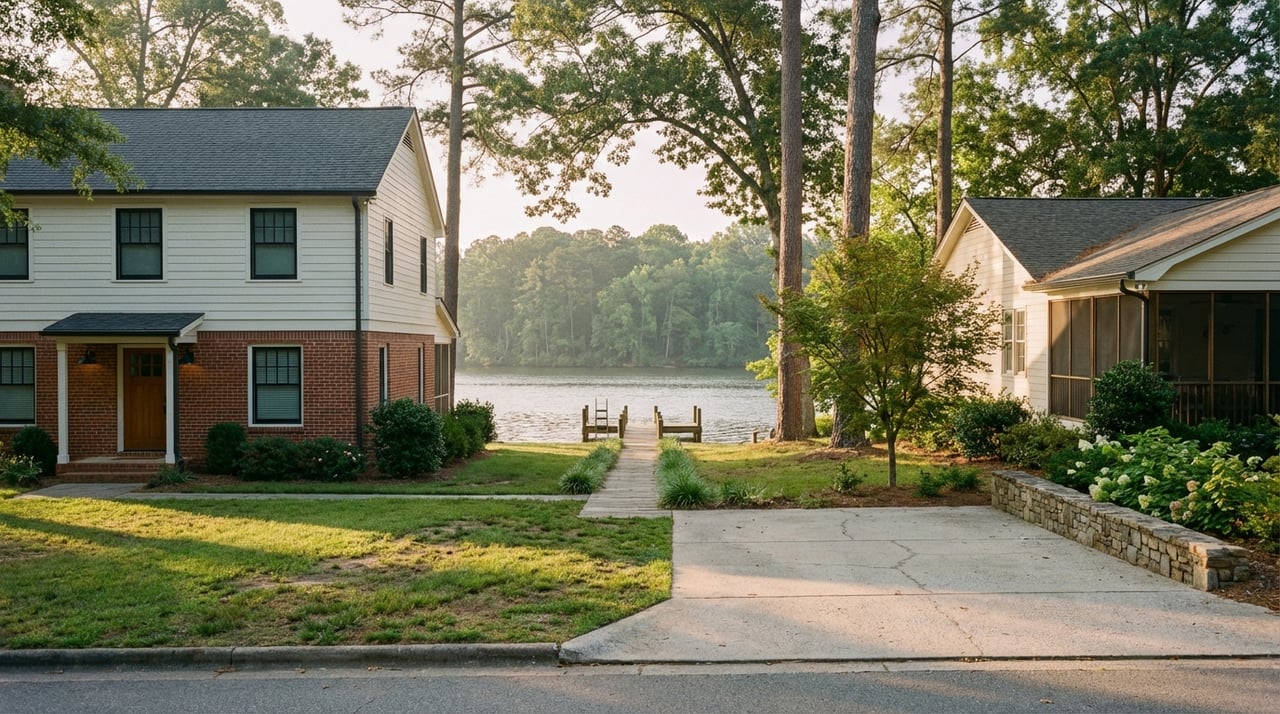
Flowery Branch sits along the southern and central portion of the lake in Hall County. That location puts you close to southern marinas, parks, and resort areas, while the upper coves and tributary-fed arms to the north usually require a longer drive. For local context, visit the City of Flowery Branch site.
North vs south at a glance
- North end = quieter coves and wooded shoreline. You will find narrow arms, natural settings, and more privacy.
- South end = marinas and amenities within shorter drives. You will find more lakeside dining, services, and social activity.
- Your best fit depends on how you boat, how often you want to be on the water, and how much you value quick access to marinas and dining.
Shoreline character and privacy
North end: natural coves and longer frontage
On the northern arms, shoreline tends to be more wooded with irregular shorelines and private coves. Many lots are deeper and can feel tucked away, which appeals if you want serenity and fewer sight-lines to other boats. Expect longer driveways and more time on local roads to reach services.
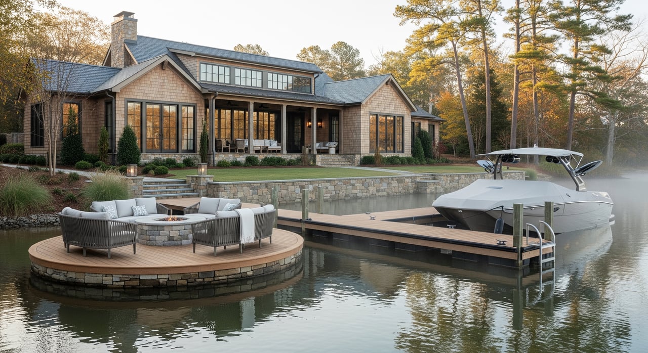
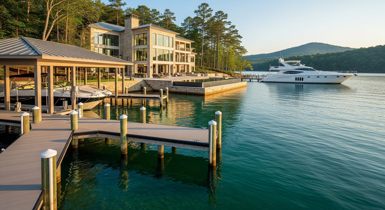
South end: developed hubs and convenience
The southern arms are more developed, with clusters of marinas, resorts, and neighborhoods closer to commercial hubs. This is a fit if you want to grab lunch by boat, fuel up, or meet friends with minimal planning. The trade-off is more daytime boat traffic in peak seasons and more visible neighbors in some pockets.
Boating and water traffic patterns
North end: calmer water and low-speed fun
Northern coves are great for fishing, kayaking, and peaceful anchoring with fewer wakes. Traffic is often lighter overall, though popular ramps or coves can get busier on holidays.
South end: active watersports and holiday crowds
Near major marinas, Lanier Islands, and public ramps, you will see more jet skis, wake boats, and tubing. Holiday weekends and summer afternoons can be crowded. If you love the energy of an active lake scene, that buzz can be part of the fun.
What to check on a tour
- Visit the dock at different times: weekday morning, weekend afternoon, and ideally a holiday.
- Ask nearby HOAs or marinas about peak-season patterns and nearby no-wake or quiet coves.
- Review boating and safety guidance from the USACE Lake Lanier resources and your planned marina.
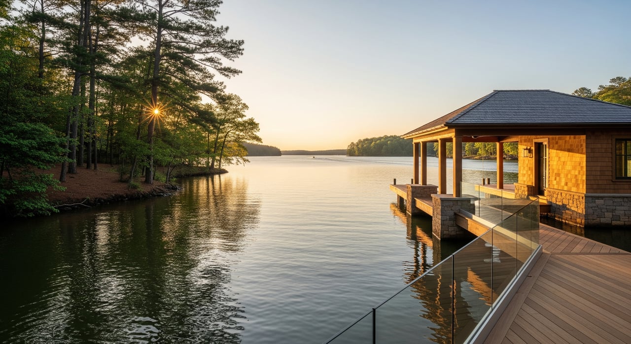
Marinas, ramps, and boat services
South end: more full-service options
You will find a higher concentration of full-service marinas, boat sales, rentals, and marine technicians around southern hubs and the Lanier Islands resort and marina. This can make fueling, storage, winterization, and lessons easier to line up.
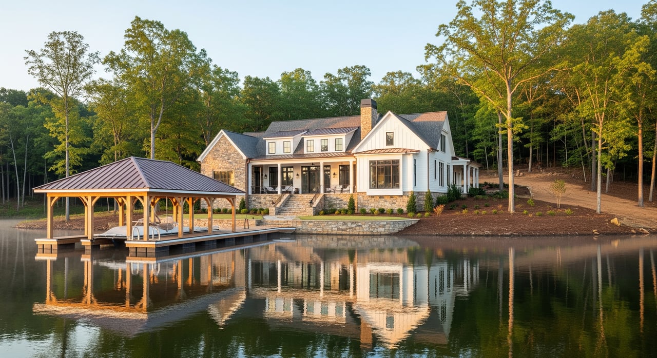
North end: fewer hubs, more private docks
There are still public ramps and local operators, but large marinas are more spread out. You will likely rely more on your private dock and quiet slip options, which can improve your overnight anchoring experience in protected coves.
Buyer checklist for boaters
- Time your drive from the home to your preferred marina or launch ramp.
- Ask about slip availability, waitlists, guest policies, and costs.
- Confirm on-site maintenance and winter storage options.
- Explore community resources and marina maps via the Lake Lanier Association.
Dining, retail, and non-lake amenities
South end: shorter trips and more choices
If you like a “lake town” vibe with lakeside dining and entertainment, the south side offers more options and typically shorter drives from Flowery Branch. Seasonal hours can vary, so confirm hours in advance.
North end: fewer lakeside spots, more seclusion
On the north end, you will often head into nearby towns for groceries and dining. This slower pace appeals if you prefer to bring supplies and enjoy time on the dock without the crowds.
Drive times from Flowery Branch
- Southern marinas and the Lanier Islands area are often about 10 to 20 minutes in typical, non-peak conditions.
- Central and northern coves can commonly run 30 to 50 minutes or more depending on which arm you choose.
- Downtown Gainesville is typically 15 to 25 minutes, and Atlanta via the I‑85 corridor is commonly 40 to 60 minutes or more depending on traffic.
Always test your route during the actual times you would leave for the lake, grocery runs, or school pickups. If you plan frequent same-day boating, a shorter drive can be a real quality-of-life win.
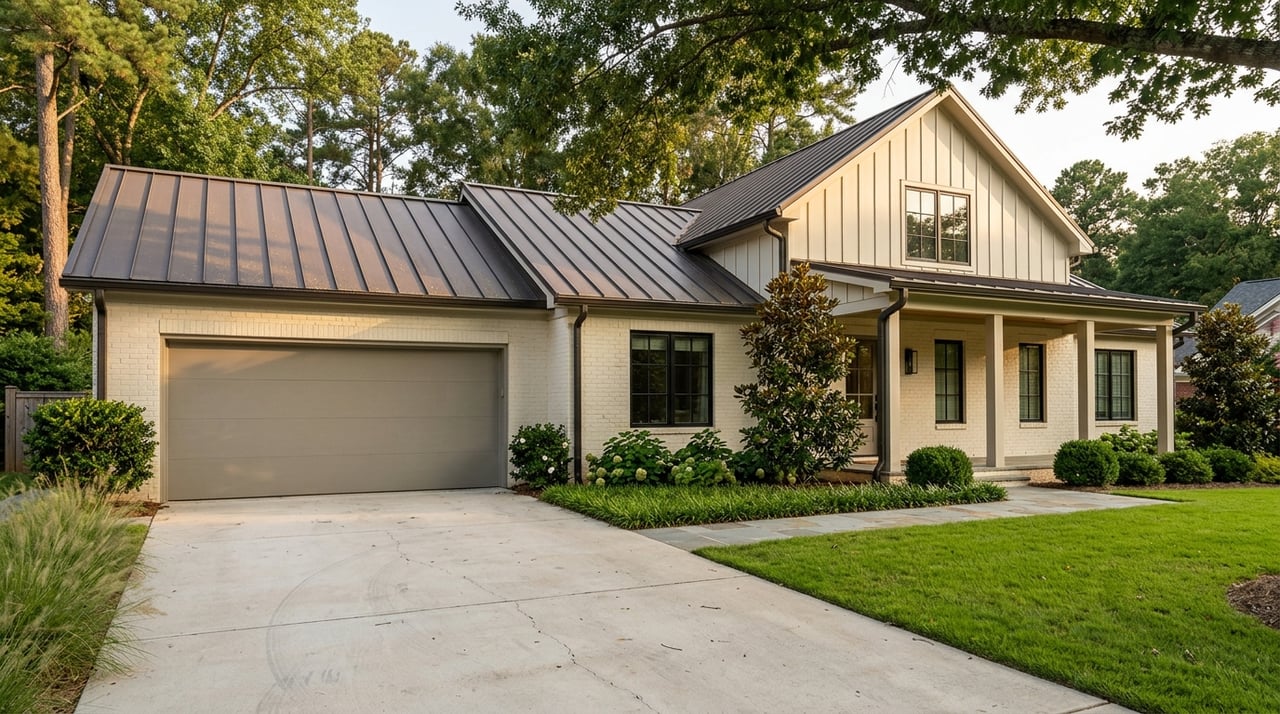
Property types and market notes
North end: privacy and deeper lots
Inventory often includes single-family homes on larger, deeper parcels. You may see a mix of older cottages and newer custom builds, and even some undeveloped land. Expect longer driveways and fewer immediate marina services.
South end: variety and near-amenity living
You can find cottages and condos near marinas, newer subdivisions, and luxury lakeside homes close to shopping and entertainment. The water can be busier in summer, yet convenience is a major draw.
Key transactional checks for both sides
- Confirm deeded water access, shared access, and whether the dock conveys with the sale. Review shoreline management and dock permits with the USACE.
- Verify FEMA flood zones, base flood elevation, and any elevation requirements. Check Hall County property and permitting resources at Hall County.
- Review HOA or POA covenants for dock rules, boat type restrictions, and rental policies.
- Determine septic vs municipal sewer, assess maintenance history, and confirm feasibility for additions.
Practical buyer checklist
Use this list while touring from Flowery Branch:
On-the-water
- Visit at varied times, including a holiday if possible.
- Check dock water depth at lower and higher water levels and look for underwater hazards.
- Confirm dock permits, whether the dock conveys, and the dock’s condition.
- Ask about authorized boat types, nearby no-wake zones, and wake regulations.
Shoreline and lot
- Measure effective shoreline frontage and how much is truly usable.
- Look for erosion control, prior shoreline stabilization, and needed permits.
- Request flood history and an elevation certificate if available.
Services and lifestyle
- Map your drive to a preferred marina, grocery, emergency care, and other routine stops.
- Confirm availability of storage, winterization, and marine mechanics.
- Decide how important waterside dining and entertainment are to your routine.
Insurance and rules
- Get home and flood insurance quotes early, since premiums vary by elevation and zone.
- Review HOA rules, rental policies, dock-sharing, noise rules, and boathouse regulations.
Market and resale
- Compare price per linear foot of shoreline within similar lake zones.
- Study recent comps and days on market for coves versus resort-adjacent areas.
Seasonality, safety, and community
- Summer holiday weekends and mid-afternoons are the busiest times lake-wide. South-central areas and resort hubs see the most density.
- Spring and fall are calmer and useful for testing a neighborhood’s daily noise and traffic.
- Lake rules are administered by the USACE and state boating authorities. Review state life jacket and boater education requirements through the Georgia Department of Natural Resources boating safety.
- South-side hubs often host festivals and concerts, while northern coves lean into neighbor-led gatherings and volunteer dock associations.
How to choose your best-fit area
- Pick your boating style. If you love fishing and kayaking in protected water, lean north. If you want wake sports, marinas, and dining access, lean south.
- Map your routine. Time the drive from Flowery Branch to marinas, ramps, grocery, and healthcare.
- Decide your traffic tolerance. If peak-season buzz energizes you, the south end fits. If you want quiet, the north end may win.
- Prioritize dock needs. Private slip at home or a full-service marina nearby.
- Confirm practicals early. Dock permits, flood zones, and septic details should factor into your short list.
Ready to see how each side lives?
You deserve clear guidance, not guesswork. If you want help narrowing options, coordinating expert inspections, and navigating dock and shoreline details with confidence, reach out. With deep Lake Lanier knowledge, luxury marketing, and responsive, concierge-level support, Michelle Sparks will help you move forward with clarity.
FAQs
Which side of Lake Lanier is quieter for everyday boating?
- The north end typically offers calmer coves and less overall density, which suits fishing, kayaking, and low-speed cruising.
How long is the drive from Flowery Branch to Lanier Islands and northern coves?
- In typical, non-peak conditions, southern marinas and Lanier Islands can be about 10 to 20 minutes, while central and northern coves can be 30 to 50 minutes or more.
Where are most marinas and boat services located on Lake Lanier?
- The south end has a higher concentration of full-service marinas and resort amenities, including the Lanier Islands marina, with the north more reliant on private docks and smaller operators.
What should I verify about docks and permits before buying?
- Confirm that the dock is permitted and conveys with the sale, and review shoreline rules with the USACE Lake Lanier. Ask for maintenance history and structural condition.
Are there specific boating safety rules I should know on Lake Lanier?
- Yes. Rules are set by the USACE and state authorities. Review life jacket, speed, and boater education requirements at the Georgia DNR boating safety.
How do flood zones affect Lake Lanier home purchases?
- Flood zones can impact insurance costs and building requirements. Verify FEMA flood maps and elevation, and consult Hall County for local property and permitting resources.